place

Charlestown Historic District

Cecil County, Maryland geography stubsEastern Shore, Maryland Registered Historic Place stubsHistoric districts in Cecil County, MarylandHistoric districts on the National Register of Historic Places in MarylandNRHP infobox with nocat
National Register of Historic Places in Cecil County, MarylandUse mdy dates from August 2023

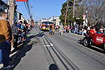
Charlestown Historic District is a national historic district at Charlestown, Cecil County, Maryland, United States. It consists of a 150-acre (0.61 km2) portion of the town containing all known existing 18th century features. There are 14 houses known to have been constructed during that century and its largest structures were the inns and hotels which served the popular Charlestown Fair in the colonial period.It was added to the National Register of Historic Places in 1975.

Excerpt from the Wikipedia article Charlestown Historic District (License: CC BY-SA 3.0, Authors).

Charlestown Historic District
Market Street,

Geographical coordinates (GPS) Address Phone number Nearby Places
placeShow on map

Wikipedia: Charlestown Historic DistrictContinue reading on Wikipedia

Geographical coordinates (GPS)

Latitude Longitude
N 39.573888888889 ° E -75.975555555556 °
placeShow on map

Address

Saint John's Methodist Church

Market Street 226
21914
Maryland, United States
mapOpen on Google Maps

Phone number

call+14102872272

Share experience

Nearby Places

Principio Furnace
Principio Furnace

Principio Furnace and village is in Cecil County, Maryland, 4 miles (6.4 km) northeast of Havre de Grace. The Principio Iron Works were started here in 1719 by Joseph Farmer with British capital and an ironmaster, John England. By the 1740s, it had become one of the most successful colonial ironworks, producing pig iron for sale in London. Later, Thomas Russell, Jr., England's successor, produced cannonballs for the Continental Army during the American Revolution.The works were part of the (larger) Principio Company, whose other holdings included the Accokeek or Potomac Ironworks on the land of George Washington's father, Augustine Washington (north of Ferry Farm near Fredericksburg, Virginia). This works was originally developed by the ironmaster England as a source of iron ore. As early as 1726, it may have included a cold blast charcoal furnace. Accokeek/Potomac served as the headquarters of the Principio Company until it was closed in the mid-1750s. The Maryland works were burnt by British forces in 1813. In 1836, the site and its ruined buildings were purchased by Joseph Whitaker, his brothers George P. Whitaker and Joseph Whitaker II, and partners Thomas Garrett (a prominent abolitionist) and William Chandler. The site still had water power; more importantly, it was crossed by the freshly laid tracks of the Philadelphia, Wilmington, and Baltimore Railroad. (Chandler was a director of the company.) The investors rebuilt the iron works and resumed production, opening a new blast furnace in 1837 and other improvements over the decades. Before the Civil War, the Whitakers divided their holdings geographically, with Joseph receiving the Pennsylvania properties and George Price the Maryland and Virginia ones. George Price Whitaker and his descendants continued to be involved in the iron and steel business; their holdings became part of the Wheeling Steel Company in 1921, and eventually of Wheeling-Pittsburgh Steel.The site produced iron until 1925. In 1972, Principio Furnace was listed on the National Register of Historic Places.Part of the stone furnace still remains on the site.

Elk Neck State Forest

Elk Neck State Forest belongs to the Maryland Department of Natural Resources and is managed by the Maryland Forest Service, and is adjacent to the town of North East, in Cecil County. It is often confused with Elk Neck State Park, which lies further south, near the end of the same peninsula. The main entrance to the state forest (with a parking lot and office) runs north off of Irishtown Road. Other entrances, blocked by gates (to deter vehicles), are located on Huminski Road and Starkey Lane. Visitors to the state forest who are not using the shooting-ranges can park for free. Users of the shooting-ranges need to acquire permits under a self-service honor-system. This nature area, consisting of 3,300 acres (13 km2), provides hiking trails, hunting opportunities (during legally established hunting seasons), and ranges for archery and for handgun- and rifle-shooting. A portion of the Mason-Dixon Trail runs through this state forest. Although there is a reduced-size area-map of the state forest online, a larger, more detailed map (including Elk Neck State Park) can be purchased from the Maryland Dept. of Natural Resources. Elk Neck State Forest is part of the Northeastern coastal forests ecoregion. It contains wooded flatland, rolling hills, and marshlands. Plum Creek and Plum Creek Pond form an important water-feature in the south-central area. The primary, wide, gravel roads within the state forest—labeled as Trails 1, 2, and 3 -- allow limited vehicle traffic (starting from the main entrance, where Trail 1 begins). These forest roads are flanked by thick woods (mixed deciduous trees and evergreens) and provide entrances (for hikers) into some forest-trails. There are small parking areas along these roads, as well as several marked small meadows with blind hunting structures, including one for handicapped hunters. The northwestern corner of Trail 1, in particular, is the location of the shooting ranges.