place

Easton Historic District (Easton, Maryland)
1980 establishments in MarylandBuildings and structures in Easton, MarylandFederal architecture in MarylandGreek Revival architecture in MarylandHistoric districts in Talbot County, Maryland
Historic districts on the National Register of Historic Places in MarylandItalianate architecture in MarylandNRHP infobox with nocatNational Register of Historic Places in Talbot County, MarylandUse mdy dates from August 2023
EASTON HISTORIC DISTRICT

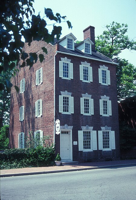
The Easton Historic District is a historic district that covers most of the core of the town of Easton, Maryland. The town is the county seat of Talbot County. The state of Maryland is nearly split by the Chesapeake Bay, and Easton is located on the east side of the bay that is known as Maryland's Eastern Shore. Although the town is part of the east coast of the United States, the region's history goes back to a time when Maryland was a colonial province of England. The Easton Historic District was added to the National Register of Historic Places in 1980. It contains approximately 900 buildings mostly built in the 18th, 19th, and early 20th centuries. Many of these buildings are residential, but the original business district, located on the west side, is also included. A notable exception to the continuity of the historic district and the construction dates is the original Quaker Third Haven Meeting House, which was constructed in the 1680s southeast of the main portion of the district.

Excerpt from the Wikipedia article Easton Historic District (Easton, Maryland) (License: CC BY-SA 3.0, Authors, Images).

Easton Historic District (Easton, Maryland)
South Street, Easton

Geographical coordinates (GPS) Address Nearby Places
placeShow on map

Wikipedia: Easton Historic District (Easton, Maryland)Continue reading on Wikipedia

Geographical coordinates (GPS)

Latitude Longitude
N 38.771944444444 ° E -76.073888888889 °
placeShow on map

Address

South Street 106
21601 Easton
Maryland, United States
mapOpen on Google Maps

EASTON HISTORIC DISTRICT
Share experience

Nearby Places

Ratcliffe Manor
Ratcliffe Manor

Ratcliffe Manor, occasionally misspelled as "Radcliffe Manor", is a Georgian colonial home completed around 1762 by Henry Hollyday. It gets its name from the "Mannour of Ratcliffe", which is one of the Maryland Eastern Shore's oldest land grants. The dwelling is considered one of the most distinctive plantation houses on Maryland's Eastern Shore, with a northeast facade on the land approach side and a nearly identical southwest facade on the river approach side. The entire property is included in the Maryland Historical Trust's Maryland Inventory of Historic Properties. A set of photographs of the estate, made in the 1930s and 1940s, is part of the Historic American Buildings Survey administered by the Library of Congress and National Park Service. The estate is located on the Tred Avon River in Talbot County near Easton, Maryland. During the War of 1812, a fort consisting of a six–gun artillery battery was constructed on Ratcliffe Manor property to protect the town of Easton from a river approach by British soldiers. Although Easton was not attacked, British troops landed further west in the county at least twice, fighting in small battles that became known as the Battle of St. Michaels and Second Battle of St. Michaels. The Hollyday family occupied the manor house for about 140 years. Former residents of the manor house include Richard C. Hollyday, secretary of State of Maryland; and Charles Hopper Gibson, a United States Senator. During the first half of the 20th century, Ratcliffe Manor was an agricultural and dairy complex. It was sold to diplomat Gerard C. Smith and his wife in 1945, and they restored the house and its grounds. The Smith family members began selling portions of the property in 1995. By the end of the century, plans were made to sell a portion of the manor grounds for development. Today, the privately owned plantation house still stands, separated by a wooded area from a planned community called Easton Village.