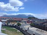
Philippi, Western Cape
Suburbs of Cape TownTownships in the Western Cape

Philippi is a large urban and semi-urban area in Cape Town's Cape Flats region, in the Western Cape, South Africa. It comprises the Philippi Horticultural Area to the west, and the neighbourhoods of Brown's Farm, Philippi East and Samora Machel located within its eastern half. The neighbourhoods of Gugulethu and Nyanga are located to its north. The horticultural area is sparsely populated compared to the surrounding city and contains many farms.
Excerpt from the Wikipedia article Philippi, Western Cape (License: CC BY-SA 3.0, Authors, Images).Philippi, Western Cape
Papkuilsvlei Road,
Geographical coordinates (GPS) Address Nearby Places Show on map
Geographical coordinates (GPS)
| Latitude | Longitude |
|---|---|
| N -34.016666666667 ° | E 18.55 ° |
Address
Papkuilsvlei Road
Papkuilsvlei Road
7766 , Philippi - Farmland
Western Cape, South Africa
Open on Google Maps


