Rushbrooke with Rougham
Borough of St EdmundsburyCivil parishes in SuffolkSuffolk geography stubs

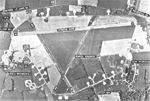
Rushbrooke with Rougham is a large civil parish in the West Suffolk district of Suffolk in eastern England covering the villages of Blackthorpe, Rougham and Rushbrooke as well as Rougham Airfield. Located directly south-east of Bury St Edmunds, in 2005 its population was 1,140. One 'Henry of Rushbrook' was Abbot of Bury St Edmunds from 1235 to 1248. The site of a former stately home, Rushbrooke Hall, is situated to the south of Rushbrooke. Until April 2019 it was in the St Edmundsbury district. The parish was created on 1 April 1988 from Rougham and parts of Great Barton, Great Whelnetham and Rushbrooke.
Excerpt from the Wikipedia article Rushbrooke with Rougham (License: CC BY-SA 3.0, Authors, Images).Rushbrooke with Rougham
Almshouse Road, West Suffolk Rushbrooke with Rougham
Geographical coordinates (GPS) Address Nearby Places Show on map
Geographical coordinates (GPS)
| Latitude | Longitude |
|---|---|
| N 52.23 ° | E 0.788 ° |
Address
Almshouse Road
Almshouse Road
IP30 9NQ West Suffolk, Rushbrooke with Rougham
England, United Kingdom
Open on Google Maps


