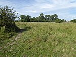
Thurston, Suffolk
Civil parishes in SuffolkEngvarB from June 2016Mid Suffolk DistrictThedwastre HundredVillages in Suffolk

Thurston is a village and a parish in Suffolk situated about 4 miles (6 km) east of Bury St Edmunds and 10 miles (16 km) west of Stowmarket. In mid-2005, Thurston's estimated population was 3,260, making it one of the larger communities in the area, falling slightly to 3,232 at the 2011 Census.Thurston railway station opened in 1846 and is still operating today. The village also has a frequent bus service to neighbouring towns, including Bury St Edmunds. The village is located under 2 miles (3 km) from the A14 and under 40 miles (64 km) from the M11 motorway.
Excerpt from the Wikipedia article Thurston, Suffolk (License: CC BY-SA 3.0, Authors, Images).Thurston, Suffolk
Stoney Lane, Mid Suffolk
Geographical coordinates (GPS) Address Nearby Places Show on map
Geographical coordinates (GPS)
| Latitude | Longitude |
|---|---|
| N 52.24994 ° | E 0.8259 ° |
Address
Stoney Lane
Stoney Lane
IP31 3SE Mid Suffolk
England, United Kingdom
Open on Google Maps


