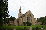
Cranford St John

Cranford St John is a village and former civil parish, now in the parish of Cranford, in the North Northamptonshire district, in the ceremonial county of Northamptonshire, England. It is in the southern half of the parish of Cranford, next to Cranford St Andrew - both named after the two parish churches. The two settlements are divided by the Alledge Brook, a tributary of the River Nene; the derivation of the name is "ford frequented by cranes or herons". In 1931 the parish had a population of 239. On 1 April 1935 the parish was abolished to form "Cranford".The only public house left is the Red Lion in Cranford St John. The old station house is the station building of the Kettering to Cambridge standard gauge railway that used to run along the side of the village. The Church was largely built in the thirteenth century, including the tower, but there is an early Norman archway in the north arcade, possibly moved from the original tower, and the rest of the arcade is late twelfth century. The south aisle was built in 1842.The former Sunday school has been converted into a residential property.
Excerpt from the Wikipedia article Cranford St John (License: CC BY-SA 3.0, Authors, Images).Cranford St John
High Street,
Geographical coordinates (GPS) Address Nearby Places Show on map
Geographical coordinates (GPS)
| Latitude | Longitude |
|---|---|
| N 52.3824 ° | E -0.64267 ° |
Address
High Street
High Street
NN14 4AA , Cranford
England, United Kingdom
Open on Google Maps


