place

Rawreth

Rochford DistrictVillages in Essex
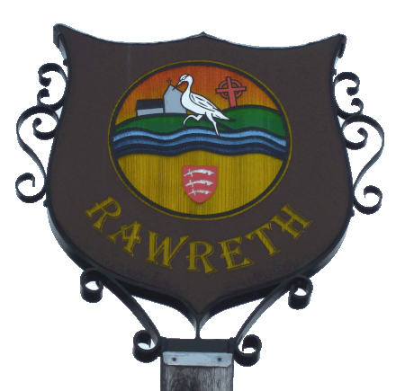
Rawreth sign
Rawreth sign

Rawreth is a village and civil parish in the District of Rochford, Essex, England. It is situated between Wickford and Rayleigh. The place-name 'Rawreth' is first attested in the Pipe Rolls for 1177, where it appears as Raggerea. It appears as Ragherethe in the Feet of Fines for 1240, and as Raureth in the Charter Rolls of 1267. The name means 'herons' stream', as seen on the Village Sign (at right). The area is mainly agricultural, sparsely populated, and with a small amount of industry. Historically most of the farmhouses in Rawreth were moated manors, many of which survive today. The original parish council was disbanded in the 1930s when the area was united with Rayleigh to form the original urban district. It was reformed in 1994 following the reorganisation of local government.

Excerpt from the Wikipedia article Rawreth (License: CC BY-SA 3.0, Authors, Images).

Rawreth
Church Road, Essex

Geographical coordinates (GPS) Address Nearby Places
placeShow on map

Wikipedia: RawrethContinue reading on Wikipedia

Geographical coordinates (GPS)

Latitude Longitude
N 51.610833 ° E 0.5725 °
placeShow on map

Address

Church Road

Church Road
SS11 8SH Essex, Rawreth
England, United Kingdom
mapOpen on Google Maps

Rawreth sign
Rawreth sign
Share experience

Nearby Places

Battlesbridge railway station

Battlesbridge railway station is on the Crouch Valley Line in the East of England, serving the village of Battlesbridge, Essex. It is 31 miles 40 chains (50.7 km) down the line from London Liverpool Street and is situated between Wickford to the west and South Woodham Ferrers to the east. The Engineer's Line Reference for the line is WIS; the station's three-letter station code is BLB. The line and station were opened on 1 June 1889 for goods and on 1 October 1889 for passenger services by the Great Eastern Railway. The station had a single platform with a station building, a goods shed, a goods yard including cattle pens, and a 34-lever signal box. The freight service was withdrawn on 4 October 1965; the goods loop and signal box were closed on 7 December 1966. All the station buildings were demolished in 1968. Electrification of the Wickford to Southminster line using 25 kV overhead line electrification (OLE) was completed on 12 May 1986. Battlesbridge station is currently managed by Greater Anglia, which also operates all trains serving it. The typical off-peak service is of one westbound train every 40 minutes to Wickford (with some peak-hour services continuing to Shenfield and/or London Liverpool Street) and one eastbound train every 40 minutes to Southminster. Since the platform is only long enough to accommodate eight carriages, any peak-hour trains formed of 12 coaches do not call at Battlesbridge.