Pentney

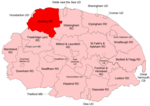
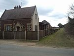
Pentney is a village and civil parish in the English county of Norfolk, located about 8 miles (13 km) south east of King's Lynn placing it about halfway between King's Lynn and Swaffham on the A47 road. It covers an area of 10.39 km2 (4.01 sq mi) and had a population of 387 in 184 households at the 2001 census, increasing to 544 at the 2011 Census. For the purposes of local government, it falls within the district of King's Lynn and West Norfolk. It is in the valley of the River Nar, a tributary of the River Great Ouse. The age of the village is unknown, but it dates at least to the 3rd or 4th centuries CE, from which time there is evidence of a Romano-British local pottery industry. A Roman road and settlement in Pentney ran close to the river Nar The name suggests that Pentney was at one time an island: one theory for the etymology is Penta's / Penda's Island, from the Anglo-Saxon Pendan-ig, the ig being equivalent to Old Norse ey = island (Pentney is on drained waterlands).
Excerpt from the Wikipedia article Pentney (License: CC BY-SA 3.0, Authors, Images).Pentney
Abbey Road, King's Lynn and West Norfolk
Geographical coordinates (GPS) Address Nearby Places Show on map
Geographical coordinates (GPS)
| Latitude | Longitude |
|---|---|
| N 52.694562 ° | E 0.543727 ° |
Address
Abbey Road
PE32 1JP King's Lynn and West Norfolk
England, United Kingdom
Open on Google Maps


