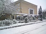
Brockley Hill
Areas of LondonDistricts of the London Borough of HarrowHills of LondonMiddlesexUse British English from August 2015

Brockley Hill, Stanmore, is an area of high ground on the outskirts of North London, England. The hill, which rises to 136 metres (446 ft) above sea level, is traversed by the A5 road. It follows the course of the Roman road known as Watling Street. The hill is also associated with the Roman archaeological site called Sulloniacis. The Royal National Orthopaedic Hospital is based at Brockley Hill.
Excerpt from the Wikipedia article Brockley Hill (License: CC BY-SA 3.0, Authors, Images).Brockley Hill
Nutt Grove, London
Geographical coordinates (GPS) Address Nearby Places Show on map
Geographical coordinates (GPS)
| Latitude | Longitude |
|---|---|
| N 51.63 ° | E -0.3 ° |
Address
Nutt Grove
Nutt Grove
HA8 8DF London (London Borough of Barnet)
England, United Kingdom
Open on Google Maps


