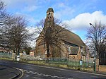
Sneinton

Sneinton (pronounced "Snenton") is a village and suburb of Nottingham, England. The area is bounded by Nottingham city centre to the west, Bakersfield to the north, Colwick to the east, and the River Trent to the south. Sneinton now lies within the unitary authority of Nottingham, having been part of the borough of Nottingham since 1877. Sneinton has existed as a village since at least 1086, but remained relatively unchanged up until the industrial era, when the population dramatically expanded. Further social change in the post-war period left Sneinton with a multicultural character. Sneinton residents of note include William Booth, founder of The Salvation Army, and mathematician George Green, who worked Green's Mill at the top of Belvoir Hill.
Excerpt from the Wikipedia article Sneinton (License: CC BY-SA 3.0, Authors, Images).Sneinton
Kentwood Road, Nottingham Sneinton
Geographical coordinates (GPS) Address Nearby Places Show on map
Geographical coordinates (GPS)
| Latitude | Longitude |
|---|---|
| N 52.951 ° | E -1.124 ° |
Address
Kentwood Road 110
NG2 4FN Nottingham, Sneinton
England, United Kingdom
Open on Google Maps


