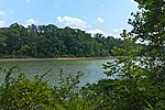
Fort Frederick State Park
1922 establishments in MarylandAmerican Civil War on the National Register of Historic PlacesAmerican Revolution on the National Register of Historic PlacesBritish-American culture in MarylandBritish forts in the United States ... and 14 more
Civilian Conservation Corps in MarylandCivilian Conservation Corps museumsColonial forts in MarylandForts in MarylandForts on the National Register of Historic Places in MarylandHistoric American Buildings Survey in MarylandMilitary and war museums in MarylandMuseums in Washington County, MarylandNational Historic Landmarks in MarylandNational Register of Historic Places in Washington County, MarylandParks in Washington County, MarylandProtected areas established in 1922State parks of MarylandState parks of the Appalachians

Fort Frederick State Park is a public recreation and historic preservation area on the Potomac River surrounding the restored Fort Frederick, a fortification active in the French and Indian War (1754–1763) and the American Revolutionary War (1775-1783). The state park lies south of the town of Big Pool, Maryland. The Chesapeake and Ohio Canal runs through the park grounds. The site was designated a National Historic Landmark in 1973.
Excerpt from the Wikipedia article Fort Frederick State Park (License: CC BY-SA 3.0, Authors, Images).Fort Frederick State Park
Gehr Road,
Geographical coordinates (GPS) Address Website External links Nearby Places Show on map
Geographical coordinates (GPS)
| Latitude | Longitude |
|---|---|
| N 39.610277777778 ° | E -78.003611111111 ° |
Address
Fort Frederick State Park
Gehr Road
21711
Maryland, United States
Open on Google Maps


