place

St Blazey Gate

St BlazeyUse British English from June 2012Villages in Cornwall

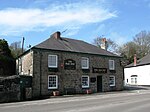
St Blazey Gate (Cornish: Yet Lanndreth) is a settlement in south Cornwall, England, United Kingdom in the civil parish of St Blaise. It is situated between the towns of St Blazey and Par on the A390 to St Austell. The settlement formed around a toll gate on the turnpike road to St Austell. The toll house is now a private residence.St Mary's Church is the parish church of Church of England parish of Par. It was built on land given by Edward Carlyon the owner of the nearby Tregrehan House and was consecrated on 1 November 1849. It was designed by George Edmund Street, his first commission, and built from the local reddish coloured Biscovey slate with quoins of Pentewan stone from the cliffs near Mevagissey.The Biscovey Stone is the shaft of an ancient Celtic cross. It was inscribed but the text is no longer readable. There are several theories about the stone, one says it dates from around 600 AD to show the Saxon advance into the county, another puts the date at around 900 AD. The head is thought to have been removed during the reformation. The stone served as a gate post near the St Blazey turnpike gate. In 1896 it was moved to St Mary's Church.

Excerpt from the Wikipedia article St Blazey Gate (License: CC BY-SA 3.0, Authors).

St Blazey Gate
St Austell Road,

Geographical coordinates (GPS) Address Nearby Places
placeShow on map

Wikipedia: St Blazey GateContinue reading on Wikipedia

Geographical coordinates (GPS)

Latitude Longitude
N 50.3507 ° E -4.7286 °
placeShow on map

Address

St Austell Road

St Austell Road
PL24 2EE , St. Blaise
England, United Kingdom
mapOpen on Google Maps

Share experience

Nearby Places

Carlyon Bay
Carlyon Bay

Carlyon Bay (Cornish: Caryones, meaning forts) is a bay and a set of three beaches (Crinnis, Shorthorn and Polgaver) near St Austell on the south coast of Cornwall, England, United Kingdom. It is located approximately 2 miles (3 km) east of the town centre.Between 1920 and the Second World War, Carlyon Bay was the site of the New Cornish Riviera Lido and large sports facilities. After the war it became known as the Cornish Leisure World. A large venue, the Cornwall Coliseum, opened in the 1950s, it hosted exhibitions, tennis tournaments and concerts by musicians, but lost its importance with the opening of the Plymouth Pavilions in 1991. The venue continued until early 2003 when only the Gossips nightclub remained open, until its closure too shortly after. The building stood, falling into disrepair, until demolition began in April 2015.Since the 1990s there have been plans for development of homes and a resort complex. The area surrounding the bay was a centre of the mining industry and is now a golf course. The South West Coast Path runs along the cliff top and across the golf course. The Cliff Head Hotel was established in 1934 and stood until its demolition in 2017. Carlyon Bay is also the site of the Carlyon Bay Hotel, which stands upon and overlooks the cliff top with views of the bay. In 1979 a scene for the film Dracula was filmed at Carlyon Bay and in 1986 the music video for Is This Love? by Alison Moyet was filmed on the beach. Polgaver Beach is used by naturists.The large rock on the foreshore is known as Stack Rock