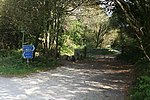
Carlyon
Beaches of CornwallCivil parishes in CornwallPopulated coastal places in CornwallRestormel geography stubs

Carlyon (Cornish: Karleghyon, meaning fort of rock-slabs) is one of four new civil parishes created on 1 April 2009 for the St Austell area of south Cornwall, England, United Kingdom. The new parish is part coastal and part rural in character. It includes the settlements of Carlyon Bay, Garker and Tregrehan Mills and is represented by nine councillors.Carlyon Bay, the principal settlement in the parish, is approximately two miles (3 km) east of St Austell.
Excerpt from the Wikipedia article Carlyon (License: CC BY-SA 3.0, Authors, Images).Carlyon
Beach Road,
Geographical coordinates (GPS) Address Nearby Places Show on map
Geographical coordinates (GPS)
| Latitude | Longitude |
|---|---|
| N 50.33724 ° | E -4.73742 ° |
Address
Beach Road
Beach Road
PL25 3SH , Carlyon
England, United Kingdom
Open on Google Maps


