place

Keukenhof

Buildings and structures in South HollandGardens in the NetherlandsLisseTourist attractions in South Holland
Keukenhof 340
Keukenhof 340

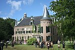
Keukenhof (English: "Kitchen garden"; Dutch pronunciation: [ˈkøːkə(n)ˌɦɔf]), also known as the Garden of Europe, is one of the world's largest flower gardens, situated in the municipality of Lisse, in the Netherlands. According to the official website, Keukenhof Park covers an area of 32 hectares (79 acres) and approximately 7 million flower bulbs are planted in the gardens annually. Keukenhof is widely known for its tulips, and it also features numerous other flowers, including hyacinths, daffodils, lilies, roses, carnations and irises.Keukenhof is located in the province of South Holland, south of Haarlem and southwest of Amsterdam in the area called the "Dune and Bulb Region" (Duin- en Bollenstreek). It is accessible by bus from Haarlem and Leiden train stations as well as Schiphol. Though its grounds are open year-round for private affairs and festivals, Keukenhof is only open to the general public for a world-renowned 8 week tulip display from mid-March to mid-May, with peak viewing arriving near mid-April, depending on growing season weather, which varies annually. In 2019, 1.5 million people visited Keukenhof, equivalent to 26,000 visitors per day. By comparison, the Rijksmuseum receives an average of 8,000 visitors per day, the Efteling receives 14,000.

Excerpt from the Wikipedia article Keukenhof (License: CC BY-SA 3.0, Authors, Images).

Geographical coordinates (GPS)

Latitude Longitude
N 52.271256 ° E 4.546365 °
placeShow on map

Address

Keukenhof

Keukenhof
2161 AM
South Holland, Netherlands
mapOpen on Google Maps

Website
keukenhof.nl

linkVisit website

linkWikiData (Q18769666)
linkOpenStreetMap (24463630)

Keukenhof 340
Keukenhof 340
Share experience

Nearby Places

Ringvaart
Ringvaart

The Ringvaart (known in full as Ringvaart of the Haarlemmermeer Polder) is a canal in the province of North Holland, the Netherlands. The Ringvaart (Dutch meaning "ring canal") is a true circular canal surrounding the Haarlemmermeer polder and forms the boundary of the Haarlemmermeer municipality. Ringvaart is also the name of the dike bordering the canal. Construction of the canal began in 1839 as the first step to reclaim land from Haarlemmermeer (Dutch for Haarlem's Lake). Thousands of laborers dug a canal through the existing land, as much as possible closely following the lake's contour. But at three locations (Vijfhuizen, Lisserbroek, and Huigsloot), the Ringvaart was dug through peninsulas which thereafter became part of Haarlemmermeer. In 1845, the canal was completed and the lake could be drained, using the Ringvaart to drain the excess waters. The canal is 61 kilometres (38 mi) long, and 2.4 metres (8 ft) deep. It encloses an area of more than 180 square kilometres (70 sq mi). The removed earth was used to build a ring dike from 30 to 50 metres (30 to 54 yd) wide around the polder. The Ringvaart is used for commercial and recreational boat traffic. A portion of it forms part of the sailroute from Hollands Diep to the IJsselmeer, passable for ships with masts over 6 meters (20 ft) tall. Near Roelofarendsveen, the Ringvaart crosses the A4 Highway by means of a navigable aqueduct. It was built in 1961, making it the oldest aqueduct in the Netherlands. In 2006, construction was completed of two new portions: on the east side for crossing new north-bound lanes for the expanded highway; and on the west side for the new HSL-Zuid high-speed railway. The new aqueduct is 1.8 kilometres (1.1 mi) long.