place

Aswarby and Scredington railway station

1872 establishments in England1930 disestablishments in EnglandDisused railway stations in LincolnshireFormer Great Northern Railway stationsPages with no open date in Infobox station
Railway stations in Great Britain closed in 1930Railway stations in Great Britain opened in 1872Use British English from August 2015
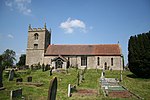
Scredington Station geograph.org.uk 154559

Aswarby and Scredington railway station was a station close to Scredington, Lincolnshire on the Great Northern Railway Bourne and Sleaford railway. It opened in 1872 and closed in 1930. It was originally shown on maps as Aswarby Station, but by 1905 it was shown as Aswarby and Scredington Station.

Excerpt from the Wikipedia article Aswarby and Scredington railway station (License: CC BY-SA 3.0, Authors, Images).

Aswarby and Scredington railway station
Station Road, North Kesteven Scredington

Geographical coordinates (GPS) Address Nearby Places
placeShow on map

Wikipedia: Aswarby and Scredington railway stationContinue reading on Wikipedia

Geographical coordinates (GPS)

Latitude Longitude
N 52.954805555556 ° E -0.38069444444444 °
placeShow on map

Address

Station Road

Station Road
NG34 0AA North Kesteven, Scredington
England, United Kingdom
mapOpen on Google Maps

Scredington Station geograph.org.uk 154559
Share experience

Nearby Places

Burton Pedwardine
Burton Pedwardine

Burton Pedwardine is a hamlet and civil parish in the district of North Kesteven, Lincolnshire, England. The population at the 2011 census was 187. The hamlet is situated approximately 4 miles (6 km) south-east from the market town of Sleaford and south-west of the village of Heckington. Burton Pedwardine is named after a Herefordshire family, the Pedwardines, who acquired the hall and manor through marriage about 1330.The village Grade II listed Anglican parish church is dedicated to St Andrew. It was rebuilt by Sir Roger Pedwardine in the early 14th century on a cruciform plan with central tower. The tower collapsed in 1802, and the church was rebuilt. It was again rebuilt in Decorated style in 1870, retaining its original transept from the pre-1802 church. A grille for the exhibition of relics, and a lead effigy of Dame Alice Pedwardine (c.1350), wife of Roger, lie in the east wall. Against the west wall is the tomb of Thomas Horsman (d. 1610), with effigies of Horsman and his wife Mary. The west wall contains decorative Saxon and Norman elements.The parish holds the site of Mareham Grange, which was the property of Sir Thomas Horsman in the late 16th, early 17th century. Earlier it was held by Sempringham Priory. The site may also have been the location of Mareham or Cold Mareham, a lost medieval village. Near the Mareham Grange earthworks is the base of a 15th-century wayside cross.A further Grade II listed building is Glebe Farmhouse on the village's Main Street.A notable murder occurred in the parish in 1728, when Captain Thomas Mitchell, a justice of the peace, killed a bailiff named Pennystone Warden of Ewerby. The captain was committed to Lincoln Castle by two of his fellow magistrates and subsequently sentenced to death at Lincoln Assizes.The Peterborough to Lincoln Railway Line runs past the village with both Scredington Road and White Cross Lane passing over the railway.