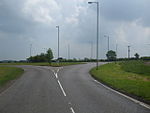
Quarrington is a village and former civil parish, now part of the civil parish of Sleaford, in the North Kesteven district of Lincolnshire, England. The old village and its church lie approximately 1 miles (2 km) south-west from the centre of Sleaford. Suburban housing developments at New Quarrington and Quarrington Hill effectively link the two settlements. Bypassed by the A15, it is connected to Lincoln and Peterborough, as well as Newark and King's Lynn (via the A17). At the 2011 census, Quarrington and Mareham ward, which incorporates most of the settlement, had an estimated population of 7,046.
Quarrington was a rural community during the early and middle Anglo-Saxon period while mills along the River Slea in the Middle Ages gave the village its likely alternative name of Millthorpe. The Bishop of Lincoln and Ramsey Abbey held manors in Quarrington after the Norman Conquest, but the Carre family of Sleaford were the principal land-owners between 1559 and 1683, when its estate passed by marriage to the Marquesses of Bristol. Although the growth of Victorian Sleaford saw the town encroach into the parish's boundaries, the old village remained a small cluster of farm buildings and cottages for much of its history. The sale of most of the surrounding farmland by successive Marquesses of Bristol in the late 20th century led to the rapid development of residential estates on Quarrington Hill and in New Quarrington which have engulfed the original settlement. Low crime rates, affordable housing, high standards of living and access to good schools have attracted home-buyers to the area, contributing to a sharp rise in the population.
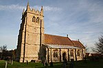
The medieval St Botolph's Church, a grade II* listed building, lies at the heart of the old village and remains a hub for the Anglican community. The village's primary school serves local children, who continue their secondary education in one of Sleaford's three secondary schools. The nearest railway station on the Grantham to Skegness and Peterborough to Lincoln lines is in Sleaford. In the 19th century, the most common employment was in agriculture and more than half of the village's population were farm labourers. By 2011, most residents were employed in the wholesale and retail trades, public administration and defence, human health and social work, and manufacturing.


