Wytham
Civil parishes in OxfordshirePopulated places on the River ThamesUse British English from August 2015Vague or ambiguous time from July 2016Vale of White Horse ... and 1 more
Villages in Oxfordshire

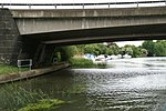
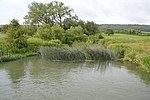
Wytham ( WY-təm) is a village and civil parish on the Seacourt Stream, a branch of the River Thames, about 3 miles (5 km) northwest of the centre of Oxford. It is just west of the Western By-Pass Road, part of the Oxford Ring Road (A34). The nearest village is Godstow. Wytham was the northernmost part of Berkshire until the 1974 boundary changes transferred it to Oxfordshire. The toponym is first recorded as Wihtham around 957, and comes from the Old English for a homestead or village in a river-bend.
Excerpt from the Wikipedia article Wytham (License: CC BY-SA 3.0, Authors, Images).Wytham
Vale of White Horse
Geographical coordinates (GPS) Address Nearby Places Show on map
Geographical coordinates (GPS)
| Latitude | Longitude |
|---|---|
| N 51.778 ° | E -1.313 ° |
Address
OX2 8QJ Vale of White Horse
England, United Kingdom
Open on Google Maps


