Godstow Lock
1790 establishments in EnglandBuildings and structures completed in 1924Buildings and structures in OxfordLocks of OxfordshireLocks on the River Thames ... and 2 more
Transport in OxfordUse British English from March 2017

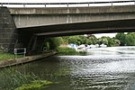
Godstow Lock is a lock on the River Thames in Oxfordshire, England. It is between the villages of Wolvercote and Wytham on the outskirts of Oxford. The first lock was built of stone by Daniel Harris for the Thames Navigation Commission in 1790. It is the lock furthest upstream on the river which has mechanical (electro-hydraulic) operation - every lock upstream of Godstow utilises manual beam operation instead. The main weir is a short way upstream but there is another weir at Godstow Bridge just above the Trout Inn. These feed into a backwater (Wolvercote Mill Stream) which has come from above King's Lock by Wolvercote.
Excerpt from the Wikipedia article Godstow Lock (License: CC BY-SA 3.0, Authors, Images).Godstow Lock
Godstow Road, Oxford
Geographical coordinates (GPS) Address Nearby Places Show on map
Geographical coordinates (GPS)
| Latitude | Longitude |
|---|---|
| N 51.77667 ° | E -1.29843 ° |
Address
Godstow Abbey (Godstow Nunnery)
Godstow Road
OX2 8PN Oxford
England, United Kingdom
Open on Google Maps


