Godstow
1133 establishments in England1539 disestablishments in EnglandAreas of OxfordBenedictine nunneries in EnglandChristian monasteries established in the 12th century ... and 5 more
Christianity in OxfordMonasteries in OxfordPopulated places on the River ThamesRuins in OxfordshireUse British English from July 2022

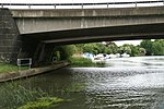
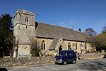
Godstow is a hamlet about 2.5 miles (4 km) northwest of the centre of Oxford. It lies on the banks of the River Thames between the villages of Wolvercote to the east and Wytham to the west. The ruins of Godstow Abbey, also known as Godstow Nunnery, are here. A bridge spans the Thames and the Trout Inn is at the foot of the bridge across the river from the abbey ruins. There is also a weir and Godstow lock.
Excerpt from the Wikipedia article Godstow (License: CC BY-SA 3.0, Authors, Images).Godstow
Godstow Road, Oxford
Geographical coordinates (GPS) Address External links Nearby Places Show on map
Geographical coordinates (GPS)
| Latitude | Longitude |
|---|---|
| N 51.7784 ° | E -1.2997 ° |
Address
Godstow Abbey (Godstow Nunnery)
Godstow Road
OX2 8PN Oxford
England, United Kingdom
Open on Google Maps


