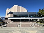
The UC Irvine Institute of Transportation Studies (ITS), is a University of California organized research unit with sister branches at UC Davis, and UC Berkeley. ITS was established to foster research, education, and training in the field of transportation. UC Irvine ITS is located on the fourth floor of the Anteater Instruction and Research Building at University of California, Irvine's main Campus, and also houses the UC Irvine Transportation Science graduate studies program.
A fundamental goal of the Institute is the stimulation of interdisciplinary research on contemporary transportation issues. ITS research involves faculty and students from The Henry Samueli School of Engineering, the School of Social Sciences, the School of Social Ecology, the Paul Merage School of Business, the School of Law, and the Bren School of Information and Computer Science. The Institute also hosts visiting scholars from the U.S. and abroad to facilitate cooperative research and information exchange, and sponsors conferences and colloquia to disseminate research results. ITS is also part of the University of California Transportation Center (UCTC), one of ten federally designated centers for transportation research and education, and a member of the Council of University Transportation Centers (CUTC).
Research at ITS covers a broad spectrum of transportation issues. Current funded research projects at Irvine focus upon:
Intelligent transportation systems, particularly advanced transportation management systems
Analysis and simulation of urban traffic networks
Transportation system operations and control
Artificial intelligence/expert systems in transportation
Travel demand forecasting and analysis of complex travel behavior
Transportation/land use interactions, particularly those which encourage alternative modes of travel
Planning and evaluation of advanced public transit systems
Transportation pricing and regulation
Energy and environmental issues, particularly demand for alternative fuels
Effect of land-use on transportation demand
Growth of automobile use in the U.S. and Western EuropeResearch on advanced transportation technologies, a focus at Irvine, is supported by a wide range of programs. These include:
Advanced Testbed Research Program, a state and federally supported effort headquartered at UCI. This program is developing and evaluating new technologies for traffic system monitoring and control.
Program for Improved Vehicle Demand Forecasting Models. Sponsored by the California Energy Commission, this program is investigating the state's potential market for clean fuel vehicles.
Partnership for Advanced Transit and Highways (PATH), a state-sponsored research program on intelligent transportation systems. Headquartered at the University of California, Berkeley (UCB), with participation from UCI, this program has an annual solicitation for research ideas in Intelligent Transportation Systems.
PATH Advanced Transportation Management Systems (ATMS) Center. Headquartered at UCI, this PATH center focuses on the research and development of ATMS technologies.
The ITS Advanced Transportation Management System (ATMS) Laboratories at Irvine provide facilities for teaching, research, and development of high-technology applications in transportation. The laboratories include workstations tied directly to a modern traffic management center and to the local California Department of Transportation (Caltrans) district's freeway traffic management center. The laboratories also contain a network of Unix-based workstations and personal computers, and a variety of software in transportation engineering and control.
A statewide video teleconferencing facility, video camera, recorders, monitors and accessories enable research in advanced traffic detection, monitoring and analysis. Additional features of the ATMS Laboratories include advanced traffic signal controllers and a variety of traffic data collection devices. These laboratories form the backbone of California's research initiative in ATMS and, together with the California ATMS Testbed established in Orange County as part of that initiative, provide unparalleled opportunity for the development and testing of applications of advanced technology in the management of transportation systems.The transportation research program at Irvine is also supported by computerized access to the ITS Transportation Library at UC Berkeley. In addition to the resources available from the ITS Berkeley Library, ITS at UCI subscribes to the major transportation research journals and offers a variety of computer-based information retrieval services. ITS is linked to the broader professional community through a series of research colloquia and specialty conferences. The latter programs attract an international audience.
The Institute also houses the UC Irvine Transportation Science graduate program.
The Institute maintains a regular publication series which documents research conducted within its programs. The Institute maintains the Frank Haight Memorial Library located in the Anteater Instructional Research Building on campus, named after Emeritus Professor Frank Haight, who founded three of the most influential journals in transportation research: Transportation Research Part A and B, and Accident Analysis and Prevention.


