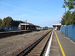
History of Folkestone

The history of Folkestone stretches back to ancient times, with evidence of human habitation dating to the Mesolithic and Paleolithic ages over 12,000 years ago. Its close proximity to the Continent means that it has often been a point of transit for migrating peoples. The area has successively been occupied by groups of Britons, Romans and Saxons. During the Iron Age, a large oppidum and quern-stone workshop were situated on the eastern headlands of the bay. By the Roman era, it had been transformed into a large Roman Villa overlooking the sea. During the Anglo-Saxon period, Folkestone was part of the Kingdom of Kent. After the Norman Invasion, a Norman knight held the Barony of Folkestone, by which time the settlement had become a fishing village. In the 13th century, it became part of the Cinque Ports, and had the privileges of a wealthy trading port. By the start of the Tudor period it had become a town in its own right. Wars with France meant that defences had to be built here; and plans for Folkestone Harbour were made. At the beginning of the 18th century the harbour finally became a reality, and Folkestone, like most settlements on the south coast, became involved in smuggling. However, it was the coming of the railways in mid-19th century that were the making of the town's prosperity: with it came the tourist trade, and the two industries, port and seaside resort, benefited the town until changes in tourist opportunities in the mid 20th century brought about its present somewhat depleted fortunes.
Excerpt from the Wikipedia article History of Folkestone (License: CC BY-SA 3.0, Authors, Images).History of Folkestone
Godwyn Gardens, Folkestone and Hythe District Morehall
Geographical coordinates (GPS) Address Nearby Places Show on map
Geographical coordinates (GPS)
| Latitude | Longitude |
|---|---|
| N 51.08 ° | E 1.16 ° |
Address
Godwyn Gardens
Godwyn Gardens
CT20 2JZ Folkestone and Hythe District, Morehall
England, United Kingdom
Open on Google Maps


