Engadin

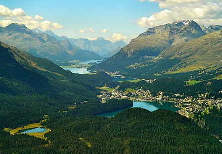
The Engadin or Engadine (Romansh: ; German: ; Italian: Engadina; French: Engadine) is a long high Alpine valley region in the eastern Swiss Alps in the canton of Graubünden in southeasternmost Switzerland with about 25,000 inhabitants. It follows the route of the Inn (Romansh: En) from its headwaters at Maloja Pass in the southwest running roughly northeast until the Inn flows into Austria, little less than one hundred kilometers downstream. The En/Inn subsequently flows at Passau into the Danube, making it the only Swiss river to drain into the Black Sea. The Engadine is protected by high mountain ranges on all sides and is famous for its sunny climate, beautiful landscapes and outdoor activities.
Excerpt from the Wikipedia article Engadin (License: CC BY-SA 3.0, Authors, Images).Engadin
Via d'Isellas,
Geographical coordinates (GPS) Address Nearby Places Show on map
Geographical coordinates (GPS)
| Latitude | Longitude |
|---|---|
| N 46.5497 ° | E 9.8959 ° |
Address
Via d'Isellas
Via d'Isellas
7502
Grisons, Switzerland
Open on Google Maps


