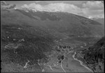
Pizzo Erra
Lepontine AlpsMountains of SwitzerlandMountains of TicinoMountains of the AlpsTicino mountain stubs

Pizzo Erra is a mountain of the Lepontine Alps, located in the Swiss canton of Ticino. It is located south of the pass of Basso di Nara, on the subrange that separates the main valley of Leventina from the valley of Blenio. At 2,416 metres (7,927 ft) above sea level, its summit can be accessed with trails from both western and eastern side.
Excerpt from the Wikipedia article Pizzo Erra (License: CC BY-SA 3.0, Authors, Images).Pizzo Erra
Circolo d'Acquarossa
Geographical coordinates (GPS) Address Nearby Places Show on map
Geographical coordinates (GPS)
| Latitude | Longitude |
|---|---|
| N 46.441083333333 ° | E 8.8909444444444 ° |
Address
Alpe del Gualdo
6716 Circolo d'Acquarossa
Ticino, Switzerland
Open on Google Maps


