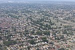
Laurelton, Queens
Communities developed by Dean AlvordLaurelton, QueensNeighborhoods in Queens, New York

Laurelton is a largely middle-class neighborhood in the New York City borough of Queens and part of the former town of Jamaica. Merrick Boulevard, which bisects the community in a generally east–west direction, forms its commercial spine. It is bounded by Springfield Boulevard to the west, 121st Avenue to the north, Laurelton Parkway to the east, and Conduit Avenue to the south. Laurelton is located in Queens Community District 13 and its ZIP Codes are 11413 and 11422. It is patrolled by the New York City Police Department's 105th Precinct.
Excerpt from the Wikipedia article Laurelton, Queens (License: CC BY-SA 3.0, Authors, Images).Laurelton, Queens
226th Street, New York Queens
Geographical coordinates (GPS) Address Nearby Places Show on map
Geographical coordinates (GPS)
| Latitude | Longitude |
|---|---|
| N 40.675 ° | E -73.745 ° |
Address
226th Street 135-23
11413 New York, Queens
New York, United States
Open on Google Maps


