place

Cambria Heights, Queens

Cambria Heights, QueensNeighborhoods in Queens, New York
Cambria Heights
Cambria Heights

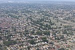
Cambria Heights is a residential neighborhood in the southeastern portion of the New York City borough of Queens. It is bounded by Springfield Boulevard and Francis Lewis Boulevard to the west, the Elmont, Nassau County border on the east, Queens Village to the north, St. Albans to the west, and Montefiore Cemetery and Laurelton, Springfield Gardens and Rosedale to the south. As of 2010, Cambria Heights's population was 18,677. The neighborhood is part of Queens Community Board 13.

Excerpt from the Wikipedia article Cambria Heights, Queens (License: CC BY-SA 3.0, Authors, Images).

Cambria Heights, Queens
225th Street, New York Queens

Geographical coordinates (GPS) Address Nearby Places
placeShow on map

Wikipedia: Cambria Heights, QueensContinue reading on Wikipedia

Geographical coordinates (GPS)

Latitude Longitude
N 40.695 ° E -73.735 °
placeShow on map

Address

225th Street 116-15
11411 New York, Queens
New York, United States
mapOpen on Google Maps

Cambria Heights
Cambria Heights
Share experience

Nearby Places

Springfield Boulevard

Springfield Boulevard is a major north/south roadway that runs through the eastern section of Queens, New York. It is 7.8 miles (12.6 km) long and goes from Northern Boulevard in Bayside, to 147th Avenue in Springfield Gardens. Springfield Boulevard runs through Bayside, Oakland Gardens, Queens Village, Cambria Heights, Laurelton, Springfield Gardens and along the eastern border of St. Albans. The name "Springfield," derived from the Springfield Armory, is one of several firearms-oriented street names in the area. This is the result of the National Rifle Range having been situated on the grounds of what is now Creedmoor State Hospital during the 19th and early 20th centuries. The north end of Springfield Boulevard is a simple two-way two lane street in southeastern Bayside. It gradually gets wider as it heads towards Springfield Gardens. At some time the city widened Springfield Boulevard in Queens Village from 112th Avenue to Jamaica Avenue, in character with its name as a "Boulevard". South of Jamaica Avenue, it gains a strip median used as a turning lane for intersections, and south of 112th Avenue all the way to 147th Avenue, it gains a median divider. The Q1, Q2, Q27, Q77, Q83, Q85 and Q88 bus lines all serve Springfield Boulevard. Springfield Boulevard intersects with many major roads including Northern Boulevard, Union Turnpike, Hillside Avenue, Jamaica Avenue, Hempstead Avenue, Linden Boulevard, Francis Lewis Boulevard and Merrick Boulevard. At its southern end, Springfield Boulevard once continued to Rockaway Boulevard; however, frequent flooding led to that stretch being closed. The land there has been developed into a distribution center. Many high schools are located near Springfield Boulevard, including Springfield Gardens High School, Martin Van Buren High School, and Benjamin Cardozo High School. Queensborough Community College is also located fairly close to Springfield Boulevard in Bayside.

Mall 211

Mall 211 is a series of nine traffic medians on 211th Street, between 99th Avenue and Hollis Avenue in the Bellaire section of the Queens Village neighborhood of Queens. When the Bellaire section was developed in 1907, a wide road connecting to the Bellaire station on the Long Island Rail Road was given a green median with nine traffic islands serving as a centerpiece of the planned suburban community. Bellaire Boulevard connected two historic roads that predate the neighborhood’s development, Jamaica Avenue and Hollis Avenue.Prior to its development as a residential community, the nearly 40 acres around Mall 211 were part of Interstate Park, a shooting range and casino operated by the National Trapshooting Association. At its annual Grand American tournament, flying birds were released from their cages and shot by trained marksmen. The park held its first tournament in 1900 but declared bankruptcy two years later after the state passed a law prohibiting pigeon-shooting competitions. Interstate Park was sold for residential development in 1906. At the request of developer Parvin Harbaugh, the Interstate Park station was renamed Bellaire and the neighborhood also adopted this name. Bellaire Boulevard was later designated as 211th Street in compliance with the grid laid out across all of Queens. Although the Bellaire station closed in 1972 as a result of low usage, the Bellaire community remains an attractive neighborhood due to its suburban appearance and the half-hour commute to Midtown Manhattan from the nearby Queens Village station.