Winchester Park, Philadelphia
Neighborhoods in PhiladelphiaNortheast Philadelphia
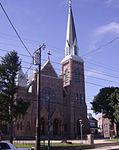
Winchester Park is a neighborhood in Far Northeast Philadelphia. It is located in the vicinity of Pennypack Park, north and west of Holmesburg.It is a neighborhood of single family homes. The first part of the development, on Winchester Avenue between Albion Street and 75' east of Holmehurst Ave was built in 1940. The remainder of the area was built between 1947- 1955. In 1955 St Jerome R.C. Church, was built at Colfax and Stamford Streets. It is the parish that serves the area. The zip code is 19136. Winchester Park's boundaries are Holme Avenue, Welsh Road and Rhawn Street.
Excerpt from the Wikipedia article Winchester Park, Philadelphia (License: CC BY-SA 3.0, Authors).Winchester Park, Philadelphia
Pennypack Trail, Philadelphia
Geographical coordinates (GPS) Address Nearby Places Show on map
Geographical coordinates (GPS)
| Latitude | Longitude |
|---|---|
| N 40.046 ° | E -75.019 ° |
Address
Pennypack Trail
Pennypack Trail
19136 Philadelphia
Pennsylvania, United States
Open on Google Maps


