Stainland and Holywell Green railway station
Disused railway stations in CalderdaleEllandFormer Lancashire and Yorkshire Railway stationsPages with no open date in Infobox stationRailway stations in Great Britain closed in 1929 ... and 3 more
Railway stations in Great Britain opened in 1875Use British English from August 2017Yorkshire and the Humber railway station stubs

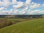
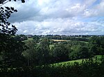
Stainland and Holywell Green railway station served the villages of Stainland and Holywell Green in West Yorkshire, England from 1875 until 1929. Goods services ended in 1959. It was situated in the eastern part of Holywell Green.
Excerpt from the Wikipedia article Stainland and Holywell Green railway station (License: CC BY-SA 3.0, Authors, Images).Stainland and Holywell Green railway station
Mill Lane, Calderdale Stainland & District
Geographical coordinates (GPS) Address External links Nearby Places Show on map
Geographical coordinates (GPS)
| Latitude | Longitude |
|---|---|
| N 53.673299 ° | E -1.864275 ° |
Address
Stainland and Holywell Green
Mill Lane
HX4 9BE Calderdale, Stainland & District
England, United Kingdom
Open on Google Maps


