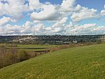
West Vale
Geography of CalderdaleUse British English from April 2020Villages in West Yorkshire

West Vale is a village in Calderdale, West Yorkshire, England. The village falls within the Greetland and Stainland parish of the Calderdale Council. It is 2.5 miles (4.0 km) south of Halifax, 2 miles (3.2 km) west of Elland and 4 miles (6.4 km) north-west of Huddersfield.
Excerpt from the Wikipedia article West Vale (License: CC BY-SA 3.0, Authors, Images).West Vale
Rochdale Road, Calderdale
Geographical coordinates (GPS) Address Nearby Places Show on map
Geographical coordinates (GPS)
| Latitude | Longitude |
|---|---|
| N 53.687676 ° | E -1.854782 ° |
Address
Rochdale Road
Rochdale Road
HX4 8AL Calderdale
England, United Kingdom
Open on Google Maps


