Outlane

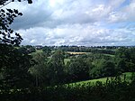
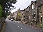
Outlane is a village in Kirklees, West Yorkshire, England, situated approximately 2.5 miles (4 km) south-west of Elland, 3.7 miles (6 km) north-west of Huddersfield and 4.5 miles (7 km) south of Halifax. The village is situated next to the M62 motorway near Junction 23 and straddles the Kirklees and Calderdale borough boundary; while the bulk of the village is within Kirklees, the north-western part of the village is part of Calderdale and the Stainland & District civil parish. The A640 Huddersfield to Rochdale road passes through the village. Outlane Cricket Club, who currently play in the Halifax Cricket League, objected to the building of the motorway in the 1960s as it would go through their ground. However the Ministry of Transport turned down the objection. Outlane has a golf course that borders the motorway. Slack Lane is the location of Slack Roman fort, whose Roman name was possibly Cambodunum.
Excerpt from the Wikipedia article Outlane (License: CC BY-SA 3.0, Authors, Images).Outlane
New Hey Road, Kirklees
Geographical coordinates (GPS) Address Nearby Places Show on map
Geographical coordinates (GPS)
| Latitude | Longitude |
|---|---|
| N 53.657 ° | E -1.874 ° |
Address
New Hey Road
New Hey Road
HD3 3FG Kirklees
England, United Kingdom
Open on Google Maps


