place

Wamesit Canal-Whipple Mill Industrial Complex

Ammunition manufacturersBuildings and structures in Lowell, MassachusettsExplosives manufacturersGunpowder millsHistoric districts in Middlesex County, Massachusetts
Historic districts on the National Register of Historic Places in MassachusettsMiddlesex County, Massachusetts Registered Historic Place stubsNRHP infobox with nocatNational Register of Historic Places in Lowell, MassachusettsUse mdy dates from August 2023
LowellMA WhippleMillIndustrialComplex

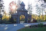
The Wamesit Canal-Whipple Mill Industrial Complex is a historic mill and canal at 576 Lawrence Street in Lowell, Massachusetts. This industrial area of Lowell, located on the Concord River, underwent a major expansion from a more modest millworks in the mid-19th century by Oliver Whipple, a manufacturer of gunpowder.

Excerpt from the Wikipedia article Wamesit Canal-Whipple Mill Industrial Complex (License: CC BY-SA 3.0, Authors, Images).

Wamesit Canal-Whipple Mill Industrial Complex
Faulkner Street, Lowell

Geographical coordinates (GPS) Address Nearby Places
placeShow on map

Wikipedia: Wamesit Canal-Whipple Mill Industrial ComplexContinue reading on Wikipedia

Geographical coordinates (GPS)

Latitude Longitude
N 42.6325 ° E -71.300833333333 °
placeShow on map

Address

Faulkner Street 14
01825 Lowell
Massachusetts, United States
mapOpen on Google Maps

LowellMA WhippleMillIndustrialComplex
Share experience

Nearby Places

South Common Historic District

The South Common Historic District of Lowell, Massachusetts, encompasses the city's South Common and the various public, religious, and private residential buildings that flank its borders. The South Common, about 22.5 acres (9.1 ha) in size, was purchased by the city in 1845 in an auction by the Proprietors of Locks and Canals, who owned much of the city's industrial area. Although the common was landscaped, it was not apparently done so to a plan. It quickly became lined with fashionable residences, and several iconic public buildings, including the 1850 courthouse, a Romantic Revival structure designed by Ammi Young, and a series of Gothic Revival churches. Highland Avenue was built out with a series of fine Italianate houses.Per the January, 1981 Massachusetts Historic Commission application, in the 1850s a land owner living on the east side of the proposed South Common, Patrick Manice, refused to sell his property to the City of Lowell. The city then enclosed his property, with he and his family within with a wooden fence. Friends supported Manice by slipping food through the slats of the fence. He surrendered his house in 1856 for $3500, and the parcel was subsequently nicknamed "Manice's Spite". In 1905, the city built a running track a baseball field and a children's gymnasium on the common as a 'city experiment'. In addition to the common, the historic district encompasses many of the surrounding buildings including: 7 residential buildings on Highland Street,7 properties on Summer Street including the Eliot Church,Eliot School on Favor Street,Hood's Laboratory (Thorndike Street) - Originally built to produce 'Hood's Sarsaparilla', the former Lowell Jail (Thorndike Street) later housing Keith Academy Catholic High School,St. John's Church (Gorham Street), St. Peter's Church and Rectory (Gorham Street) and, the Middlesex County Courthouse (Gorham Street). The district was added to the National Register of Historic Places in 1982.