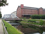
Great Stone Dam

The Great Stone Dam (also called the Lawrence Dam or Lawrence Great Dam) was built between 1845 and 1848 on the site of Bodwell's Falls on the Merrimack River in what became Lawrence, Massachusetts. The dam has a length of 900 feet (270 m) and a height of 35 feet (11 m).Lawrence is in Essex County, Massachusetts, approximately 25 miles (40 km) north of Boston and only a few miles south of the New Hampshire border (Salem), located in the Merrimack Valley. The dam is 11 miles (18 km) downstream from Lowell and is visible from Route 28 (Broadway) in Lawrence and from behind the Pacific Paper Mill (now defunct).The dam feeds two canals (North, re-built in 1848, and South, completed in 1896). At their peak, the North Canal provided up to 13,000 horsepower and the South Canal 2,000 horsepower; the Essex Company sold "mill rights" to its water power, allowing mills to use the energy provided. The North Canal existed before the dam, but was redeveloped both to better feed the mills and to accommodate the 30-foot (9.1 m) drop caused by the dam. About a mile in length, the canal had a guard lock and three lift locks with mitered gates. The locks were abandoned in the 1960s.Today the dam is the site of a hydroelectric plant, completed in 1981, which is owned by Central Rivers Power USA (now parent company of the Essex Company, which still owns the dam) and the Lawrence Hydroelectric Associates.
Excerpt from the Wikipedia article Great Stone Dam (License: CC BY-SA 3.0, Authors, Images).Great Stone Dam
South Broadway, Lawrence
Geographical coordinates (GPS) Address Nearby Places Show on map
Geographical coordinates (GPS)
| Latitude | Longitude |
|---|---|
| N 42.700833333333 ° | E -71.166666666667 ° |
Address
South Broadway
South Broadway
01840 Lawrence
Massachusetts, United States
Open on Google Maps


