place

North Canal Historic District

Bodies of water of Essex County, MassachusettsBuildings and structures in Lawrence, MassachusettsCanals in MassachusettsCanals on the National Register of Historic Places in MassachusettsHistoric districts in Essex County, Massachusetts
Historic districts on the National Register of Historic Places in MassachusettsNRHP infobox with nocatNational Register of Historic Places in Lawrence, MassachusettsTransportation buildings and structures in Essex County, MassachusettsUse mdy dates from August 2023
PembertonMill
PembertonMill

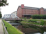
The North Canal Historic District of Lawrence, Massachusetts, encompasses the historic industrial heart of the city. It is centered on the North Canal and the Great Stone Dam, which provided the waterpower for its many mill complexes. The canal was listed on the National Register of Historic Places in 1975, while the district was first listed in 1984, and then expanded slightly in 2009.The city of Lawrence was founded by industrialist Abbott Lawrence and the associates of the Essex Company as a model industrial city. In 1845 they company acquired land from then towns of Methuen and Andover and began construction on the North Canal and the Great Stone Dam. The work included dredging and building out of "new land", and effectively created a small island between the Merrimack River and the canal, whose outlet is at the mouth of the Spicket River. Work on these two major features was completed in 1848, and development of the city, which formally incorporated in 1853, proceeded from there. The historic district encompasses, in addition to the canal and the dam, the mill-related buildings on the island and on the north side of the canal, as well as a few buildings that front on Methuen and Union Streets, or the connecting side streets. The 2009 expansion of the district, included a single building, the Morehouse Bakery building at 5-9 Mill Street.

Excerpt from the Wikipedia article North Canal Historic District (License: CC BY-SA 3.0, Authors, Images).

North Canal Historic District
Canal Street, Lawrence

Geographical coordinates (GPS) Address Nearby Places
placeShow on map

Wikipedia: North Canal Historic DistrictContinue reading on Wikipedia

Geographical coordinates (GPS)

Latitude Longitude
N 42.705 ° E -71.158055555556 °
placeShow on map

Address

242 Canal

Canal Street 242
01840 Lawrence
Massachusetts, United States
mapOpen on Google Maps

PembertonMill
PembertonMill
Share experience

Nearby Places

Wood Worsted Mill
Wood Worsted Mill

The Wood Worsted Mill is located at South Union St. and Merrimack Street, on the south bank of the Merrimack River, in Lawrence, Massachusetts. The mill building was constructed between 1906 and 1909 for the American Woolen Company, and was dubbed by some locals as the "eighth wonder of the world" due to its size. It is a six-story brick building that is 1,300 feet (400 m) long and 125 feet (38 m) high, and encompasses some 17 miles (27 km) of aisles. Its purpose when built was to perform the complete textile manufacturing cycle of worsted woolens, from raw material to finished fabric, under a single roof.The surviving mill elements include the main building and a portion of a storehouse. The storehouse is a seven-story brick building located just east of the main building, of which approximately half remains from its original construction. The two sections (of an original four) were demolished in 2009, along with a number of other structures in the complex, including sections of the main mill building.The main mill building as it now stands is divided into four parts, featuring Romanesque Revival styling executed in brick with granite and cast stone detailing. The first is an office section, which protrudes from the main body. Like the main part of the building it is six stories, but is topped by a clock tower. The other three sections were originally labelled D, E, and F, and extend eastward from the office. Section D is 33 window bays, E is 42, and F 45 window bays in length. There are three stairwell towers that interrupt the pier-and-spandrel construction of the length of the building on its south (street-facing) elevation. These stairhouses are where entry is gained to the premises, through doorways recessed under arches. The north facade, facing the river, is uniformly window bays, broken only by wrought iron fire escapes and a few bricked-up bays where the building was connected to the demolished A, B, and C sections via covered bridges over a railroad spur.The mill complex was listed on the National Register of Historic Places on August 12, 2010. At the time of the listing, section D was being converted to residential housing.