place

Lake Carmel (New York)

1928 establishments in New York (state)Commons category link is locally definedProtected areas of Putnam County, New YorkReservoirs in New York (state)Reservoirs in Putnam County, New York
Lake Carmel, New York

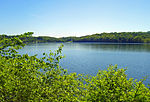
Lake Carmel is a small manmade lake located in the Town of Kent, in Putnam County, New York. It takes its name from the nearby town of Carmel, and in turn gives it to the community of Lake Carmel surrounding it. The lake was created by developers in the early 20th century by damming the Middle Branch of the Croton River. It is one of the few sizeable bodies of water in the county not a part of the New York City water supply system, but its outfall goes straight into the system's Middle Branch Reservoir downstream in the town of Carmel. Due to increasing development around the lake, the city has helped the community improve its wastewater treatment.

Excerpt from the Wikipedia article Lake Carmel (New York) (License: CC BY-SA 3.0, Authors, Images).

Lake Carmel (New York)
Lakeshore Drive East, Town of Kent

Geographical coordinates (GPS) Address Nearby Places
placeShow on map

Wikipedia: Lake Carmel (New York)Continue reading on Wikipedia

Geographical coordinates (GPS)

Latitude Longitude
N 41.459722222222 ° E -73.665 °
placeShow on map

Address

Lakeshore Drive East

Lakeshore Drive East
10512 Town of Kent
New York, United States
mapOpen on Google Maps

Lake Carmel, New York
Share experience

Nearby Places

West Branch Reservoir

The West Branch Reservoir is a reservoir in the New York City water supply system. Formed by impounding the upper reaches of the West Branch of the Croton River, it is located in the Putnam County, New York, towns of Kent, and Carmel, about 50 miles (80 km) north of New York City.Put into service in 1895, West Branch is one of 12 reservoirs in the system's Croton Watershed, and second northernmost. It receives the flow of the upstream Boyds Corner impoundment, and, when needed, of Lake Gleneida, a controlled lake in the City supply system. Primarily, however, it receives water from the much larger Rondout Reservoir in the Catskill Mountains on the west bank of the Hudson River via the Delaware Aqueduct. It serves as a supplementary settling basin for these waters before releasing its flow back into the aqueduct to be carried to the Kensico Reservoir in southern Westchester County.West Branch Reservoir has a 20 square mile (32 km²) drainage basin, and can hold up to 8 billion US gallons (30,000,000 m3) of water at full capacity. It consists of two basins, separated by State Route 301.During drought periods the West Branch also receives water pumped in from the Hudson River by the City's Chelsea Pumping Station near Beacon in Dutchess County, some 65 miles (105 km) from New York City. It was used for this purpose during the 1965–66 and 1985 droughts, as well as during May 1989. Water withdrawn from the West Branch ordinarily flows via the Delaware Aqueduct to the Kensico Reservoir in Westchester County for further settling. There it mixes with additional Catskill system water carried by the Catskill Aqueduct before entering tunnels that carry it to the Hillview Reservoir in Yonkers, at the City's northern boundary. There it enters the city's direct water supply distribution system, flowing via tunnels through the boroughs of The Bronx, Queens, and Brooklyn. The water finally stops at Staten Island. Water in excess of New York City's needs at the West Branch Reservoir goes over its spillway and into the West Branch Croton River, which is captured downstream by the Croton Falls Reservoir.