Jurong East
EngvarB from June 2017Jurong EastNew towns started in the 1970sPlaces in SingaporePlanned communities in Singapore ... and 1 more
West Region, Singapore

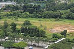
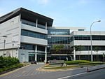
Jurong East is a planning area and residential town situated in the West Region of Singapore. It borders Jurong West and Boon Lay to the west, Clementi to the east, Tengah and Bukit Batok to the north and Selat Jurong to the south. First developed in the 1970s, it is located approximately 15 km (9.3 mi) west of the Downtown Core district. Jurong East is the 7th most populated planning area in the West Region. Jurong East, along with the entire Jurong area in general, is envisioned to be the country's second central business district (CBD) as part of the Jurong Lake District project.
Excerpt from the Wikipedia article Jurong East (License: CC BY-SA 3.0, Authors, Images).Jurong East
Science Centre Road, Singapore Jurong East
Geographical coordinates (GPS) Address Nearby Places Show on map
Geographical coordinates (GPS)
| Latitude | Longitude |
|---|---|
| N 1.3288833333333 ° | E 103.73994722222 ° |
Address
Science Centre Road
609082 Singapore, Jurong East
Singapore
Open on Google Maps


