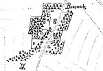
Wyględów

Wyględów [vɨglɛnduf] is a neighbourhood in the north-western part of the district of Mokotów in Warsaw, Poland. The name of the area comes from the village of Wyględów-Kościesze, which was founded in the 15th century and was placed near what is now the Bełska street. The intensive development of this area began with the construction of a fort by the Russian authorities in the second half of the 19th century. Fort Mokotów belonged to the inner ring of the forts of Warsaw. A new stage in the development of the Fort Mokotowski area, as well as other Warsaw suburbs, came in the years 1916-1917 with new proposals on joining suburban districts to the city and establishing its new borders.
Excerpt from the Wikipedia article Wyględów (License: CC BY-SA 3.0, Authors, Images).Wyględów
Racławicka, Warsaw Mokotów (Warsaw)
Geographical coordinates (GPS) Address Nearby Places Show on map
Geographical coordinates (GPS)
| Latitude | Longitude |
|---|---|
| N 52.196666666667 ° | E 20.993055555556 ° |
Address
Racławicka 105
02-634 Warsaw, Mokotów (Warsaw)
Masovian Voivodeship, Poland
Open on Google Maps


