Tulane/Gravier, New Orleans
Neighborhoods in New Orleans

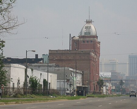
Tulane/Gravier is a neighborhood of the city of New Orleans, Louisiana, U.S.A. A subdistrict of the Mid-City District Area, its boundaries as defined by the New Orleans City Planning Commission are: St. Louis Street to the north, North Claiborne Avenue, Iberville Street, North and South Derbigny Street, Cleveland Street, South Claiborne Avenue to the east, the Pontchartrain Expressway to the south and South Broad Street to the west. Landmarks in the area include St. Joseph's Church, University Hospital, the Deutsches Haus, and the Falstaff and Dixie Breweries (both now closed).
Excerpt from the Wikipedia article Tulane/Gravier, New Orleans (License: CC BY-SA 3.0, Authors, Images).Tulane/Gravier, New Orleans
South Galvez Street, New Orleans Storyville
Geographical coordinates (GPS) Address Nearby Places Show on map
Geographical coordinates (GPS)
| Latitude | Longitude |
|---|---|
| N 29.959444444444 ° | E -90.084722222222 ° |
Address
South Galvez Street 399
70119 New Orleans, Storyville
Louisiana, United States
Open on Google Maps


