Chisworth
Civil parishes in DerbyshireHamlets in DerbyshireHigh Peak, DerbyshireTowns and villages of the Peak District

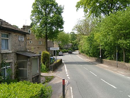
Chisworth is a hamlet near Glossop, Derbyshire, England. It is 3 miles (4.8 km) south-west of Glossop town centre, on the south side of the Etherow valley. The parish of Chisworth was formed in 1896, out of the parish of Chisworth and Ludworth. In 1901, it had a population of 409. From 1896 until 1934 it was in the Glossop Rural District, when it was placed with Ludworth into the Chapel en le Frith Rural District. The village possesses a Methodist chapel. The A626 road passes through the hamlet. In June 1930, a local cloudburst caused flooding that killed one man and destroyed equipment at the mills, one of which never reopened.
Excerpt from the Wikipedia article Chisworth (License: CC BY-SA 3.0, Authors, Images).Chisworth
Marple Road, High Peak Chisworth
Geographical coordinates (GPS) Address Nearby Places Show on map
Geographical coordinates (GPS)
| Latitude | Longitude |
|---|---|
| N 53.426 ° | E -2.015 ° |
Address
Marple Road
Marple Road
SK13 5RR High Peak, Chisworth
England, United Kingdom
Open on Google Maps


