Hattersley
Areas of Greater ManchesterEngvarB from September 2017Geography of TamesideHistory of ManchesterHousing estates in Greater Manchester ... and 1 more
Hyde, Greater Manchester

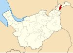
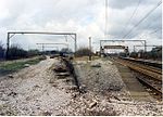
Hattersley is an area of Tameside, Greater Manchester, England; it is located 4 miles (6.4 km) west of Glossop and 10 miles (16 km) east of Manchester city centre, at the eastern terminus of the M67. Historically part of Tintwistle Rural District in Cheshire until 1974, it is the site of an overspill estate built by Manchester City Council in the 1960s. Hattersley is an area receiving major regeneration, which includes building new housing and additional retail stores.
Excerpt from the Wikipedia article Hattersley (License: CC BY-SA 3.0, Authors, Images).Hattersley
Beaufort Road, Tameside
Geographical coordinates (GPS) Address Nearby Places Show on map
Geographical coordinates (GPS)
| Latitude | Longitude |
|---|---|
| N 53.4479 ° | E -2.0278 ° |
Address
Beaufort Road
Beaufort Road
SK14 3RL Tameside
England, United Kingdom
Open on Google Maps


