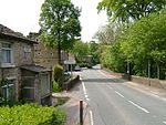
Brown Low
Buildings and structures in the Metropolitan Borough of StockportGreater Manchester building and structure stubsScheduled monuments in Greater Manchester

Brown Low is a bowl barrow most likely dating to the Bronze Age. An earth and stone mound survives east of Marple, Greater Manchester (grid reference SJ98829092). It is listed as a Scheduled Ancient Monument. The mound was partially excavated by the Rev William Marriott in 1809,: 374–391 who discovered fragments of burnt stones and cremated bones, as well as a preserved acorn. Marriott also describes the finding of a funerary urn in an adjacent barrow during an unauthorised excavation.: 377, 383 Brown Low is on private land, just east of a public footpath running off Sandy Lane.
Excerpt from the Wikipedia article Brown Low (License: CC BY-SA 3.0, Authors, Images).Brown Low
Sandhill Lane,
Geographical coordinates (GPS) Address Nearby Places Show on map
Geographical coordinates (GPS)
| Latitude | Longitude |
|---|---|
| N 53.41509 ° | E -2.019397 ° |
Address
Sandhill Lane
SK6 5NU
England, United Kingdom
Open on Google Maps


