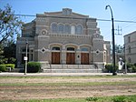
Touro, New Orleans
Neighborhoods in New OrleansNew Orleans stubs

Touro is a neighborhood of the city of New Orleans. A subdistrict of the Central City/Garden District Area, its boundaries as defined by the New Orleans City Planning Commission are: St. Charles Avenue to the north, Toledano Street to the east, Magazine Street to the south and Napoleon Avenue to the west.
Excerpt from the Wikipedia article Touro, New Orleans (License: CC BY-SA 3.0, Authors, Images).Touro, New Orleans
Austerlitz Street, New Orleans Garden District
Geographical coordinates (GPS) Address Nearby Places Show on map
Geographical coordinates (GPS)
| Latitude | Longitude |
|---|---|
| N 29.924166666667 ° | E -90.096111111111 ° |
Address
Austerlitz Street 1200
70115 New Orleans, Garden District
Louisiana, United States
Open on Google Maps


