place

Hampton Hill Historic District

Georgian architecture in ConnecticutHampton, ConnecticutHistoric districts in Windham County, ConnecticutHistoric districts on the National Register of Historic Places in ConnecticutNRHP infobox with nocat
National Register of Historic Places in Windham County, ConnecticutUse mdy dates from August 2023
Congregational Church, Hampton CT

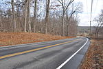
The Hampton Hill Historic District encompasses the historic village center of Hampton, Connecticut, a small rural community in Windham County. It is a linear district, extending for about 1 mile (1.6 km) along Connecticut Route 97, the major north-south route through the town, and laid out as a tree-lined boulevard. Most of the district's 62 historic buildings were built in the 19th century, with fifteen houses surviving from the 18th. Architecturally, they represent a cross-section of styles popular from the mid-18th to early 20th centuries, with vernacular forms most commonly found. One of the oldest buildings is a c. 1727 tavern, since converted to a private residence, while the town hall is located in an undistinguished 1920s former firehouse.The town of Hampton was first settled in 1709, and the name Hampton Hills became the name of the crossroads village that arose between the main north-south route (now Main Street) and an east-west route (now Old Route 6). Its first church was built here in 1728, and the town was incorporated in 1786, out of portions of adjoining towns. The town remained predominantly agricultural into the 20th century, its population declining over the 19th century. In the 20th century, the population began to grow, but industry and the railroad generally passed by the town center. The result of this development pattern is a well-preserved 19th-century rural village center.The district was listed on the National Register of Historic Places in 1982.

Excerpt from the Wikipedia article Hampton Hill Historic District (License: CC BY-SA 3.0, Authors, Images).

Hampton Hill Historic District
Main Street,

Geographical coordinates (GPS) Address Nearby Places
placeShow on map

Wikipedia: Hampton Hill Historic DistrictContinue reading on Wikipedia

Geographical coordinates (GPS)

Latitude Longitude
N 41.7825 ° E -72.055277777778 °
placeShow on map

Address

Main Street 223
06247
Connecticut, United States
mapOpen on Google Maps

Congregational Church, Hampton CT
Share experience

Nearby Places

Chaplin Historic District

The Chaplin Historic District in Chaplin, Connecticut is a historic district that was listed on the National Register of Historic Places (NRHP) in 1978. The district encompasses the historic village center of Chaplin, which extends for 0.8 miles (1.3 km) along Chaplin Street, and was most heavily developed in the early 19th century. The focal center of the district is the 1812-15 Congregational Church, which stands on a knoll overlooking the street. Most of the district's buildings are wood-frame houses, although the Witter House (separately listed on the National Register) is a notable brick structure. Stylistically most of the houses are either Federal or Greek Revival in style. In addition to the church, other public buildings include the 1840 former town hall, the 1911 Colonial Revival Ross Memorial Library building, and Eaton's Store, built in 1850.The area that is now Chaplin was settled in the 18th century, its area divided between the towns of Mansfield, Windham, and Hampton. The impetus to separate the community occurred due to the difficulty of area residents in reaching the churches in those town centers. Benjamin Chaplin, who died in 1795, bequeathed funds for the establishment of a church near his (now no longer standing) home. A village center developed around the church, and the town was incorporated in 1822. The village is unusual in Connecticut for its relatively late development, and thus survives as a good example of early 19th-century town planning. Because the center is not near usable water power, and was bypassed by railroads, it was not affected by later industrialization, and was further preserved when Connecticut Route 198 was routed past it in the 20th century.