place

Jonathan Wheeler House

Canterbury, ConnecticutGeorgian architecture in ConnecticutHouses completed in 1760Houses in Windham County, ConnecticutHouses on the National Register of Historic Places in Connecticut
National Register of Historic Places in Windham County, Connecticut
CanterburyCT JonathanWheelerHouse

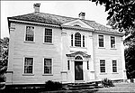
The Jonathan Wheeler House is a historic house on North Society Road in Canterbury, Connecticut. Built c. 1760, it has features unusual for its time, including end chimneys and a center-hall plan. The use of brick in this part of rural Connecticut is also unusual for the period. The house was listed on the National Register of Historic Places in 1982.

Excerpt from the Wikipedia article Jonathan Wheeler House (License: CC BY-SA 3.0, Authors, Images).

Jonathan Wheeler House
Tripp Hollow Road,

Geographical coordinates (GPS) Address Nearby Places
placeShow on map

Wikipedia: Jonathan Wheeler HouseContinue reading on Wikipedia

Geographical coordinates (GPS)

Latitude Longitude
N 41.750833333333 ° E -71.990555555556 °
placeShow on map

Address

Tripp Hollow Road 84
06331
Connecticut, United States
mapOpen on Google Maps

CanterburyCT JonathanWheelerHouse
Share experience

Nearby Places

March Route of Rochambeau's Army: Manship Road-Barstow Road

March Route of Rochambeau's Army: Manship Road-Barstow Road is a historic site in Canterbury, Connecticut that was listed on the National Register of Historic Places in 2003, for its evocation of the march route French commander Rochambeau's troops in 1781 and in 1782. It is significant as a preserved section of the march route which, in this area, is followed by what is now Connecticut Route 14. This section, however, is a bypassed loop of road, cut off by a road realignment in the 1930s, and therefore without traffic and not modernized. The section is approximately 1,400 feet of bypassed loop of road, on the north side of the main road, along Manship Road and Barstow Road, starting from a junction of the loop with Manship Road and running to Westminster Road. It is paved road about 20 feet wide, plus a margin to stone walls lining the road. The designated area is about 50 to 55 feet wide, extending to the walls. The National Register nomination of 2001 includes six photos of narrow roadway, stone walls, and the one house along this section. The house is itself historical, dating from about the 1840s, and adds rather than detracts from the historical feel.Rochambeau's troops marched through here in June, 1781, and found the road along this general area to be the most difficult along their whole journey. Although the road has been paved, the visual appearance is still evocative of passage of troops.Other preserved sections of the route nearby include March Route of Rochambeau's Army: Old Canterbury Road (about 2 miles (3.2 km) to the east, along Route 14 through Canterbury then straight on 14A, Canterbury Road) and March Route of Rochambeau's Army: Palmer Road (an approximately 2,000-foot (610 m) stretch about 3 miles (4.8 km) to the west along Route 14). Multiple other properties whose association with Rochambeau's route is known were also considered for listing on the National Register in a 2001 study.

Unitarian Meetinghouse

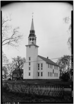
The Unitarian Meetinghouse is a historic church at the junction of Connecticut Routes 169 and 6 in the village center of Brooklyn, Connecticut. Built in 1771, it is one of a small number of pre-Revolutionary church buildings in the state, and distinctive for having a sufficiently complete documentary record to support a complete restoration. It retains a configuration distinctive of that period, with its main entrance on the long side of the building, and the pulpit opposite. The bell tower with steeple is located at one of the short ends, suggestive of the 19th century change to place the entrance there as well. The building was listed on the National Register of Historic Places in 1972.When Brooklyn was settled in the early 18th century, its territory was divided between Pomfret and Canterbury. Its religious congregation was organized in 1731, and was originally called the Mortlake Society. Its first meeting house, built in 1734, was known as the Second Church in Pomfret. The present church as built in 1771-74; the town of Brooklyn was incorporated in 1786. Its construction, first proposed in 1763, was opposed for many years by local Anglicans, resulting in the construction of Trinity Church. In the early 19th century, the congregation was split between Trinitarians and Unitarians, with the latter ultimately retaining control of this building. The building was restyled in 1845, relocating the entrance to a new tower on the side, building a full second floor at the gallery level, and replacing the box pews and pulpit. All of the interior changes were reversed in the late 20th century, restoring it to its original form. The tower, whose steeple was replaced after the New England Hurricane of 1938, was retained. The building is owned and maintained by the Unitarian Universalist Society in Brooklyn, CT. The UUSB are the direct successors of the first Unitarian congregation in Connecticut. Its first Unitarian minister, Rev. Samuel May, was a noted peace activist, education reformer, temperance crusader, supporter of women's rights, and one of the principal supporters of Prudence Crandall, the official female hero of the state of Connecticut. In 1871 the UUSB ordained the Rev. Celia Burleigh, the first female Unitarian minister and one of the first regularly ordained female ministers in any denomination.