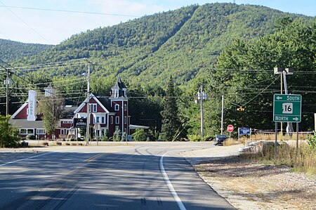
West Ossipee, New Hampshire
New Hampshire geography stubsOssipee, New HampshireUnincorporated communities in Carroll County, New HampshireUnincorporated communities in New HampshireUse mdy dates from July 2023

West Ossipee is an unincorporated community in the town of Ossipee in Carroll County, New Hampshire, United States. It is located near the northern boundary of the town, along New Hampshire Route 16, leading north towards Conway and south towards Rochester. Route 41 departs from the village, heading northeast to Silver Lake and Madison. Route 25 leads west towards Tamworth and Moultonborough. The Bearcamp River runs along the southwest side of the village. The Whittier Bridge is a historic covered bridge that crosses the river just west of the village. West Ossipee has a separate ZIP code (03890) from the rest of Ossipee.
Excerpt from the Wikipedia article West Ossipee, New Hampshire (License: CC BY-SA 3.0, Authors, Images).West Ossipee, New Hampshire
Plains Road,
Geographical coordinates (GPS) Address Nearby Places Show on map
Geographical coordinates (GPS)
| Latitude | Longitude |
|---|---|
| N 43.824722222222 ° | E -71.205277777778 ° |
Address
Plains Road
Plains Road
03875
New Hampshire, United States
Open on Google Maps


