Fort Rodman
1861 establishments in MassachusettsAmerican Civil War fortsAmerican Civil War museums in MassachusettsBuildings and structures in New Bedford, MassachusettsForts in Massachusetts ... and 8 more
Geography of Bristol County, MassachusettsHistoric districts in Bristol County, MassachusettsHistoric districts on the National Register of Historic Places in MassachusettsHistory of Bristol County, MassachusettsMuseums in Bristol County, MassachusettsNRHP infobox with nocatNational Register of Historic Places in New Bedford, MassachusettsParks in Bristol County, Massachusetts

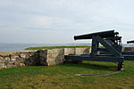
Fort Taber District or the Fort at Clark's Point is a historic American Civil War-era military fort on Wharf Road within the former Fort Rodman Military Reservation in New Bedford, Massachusetts. The fort is now part of Fort Taber Park, a 47-acre town park located at Clark's Point. Fort Taber was an earthwork built nearby with city resources and garrisoned 1861-1863 until Fort Rodman was ready for service.
Excerpt from the Wikipedia article Fort Rodman (License: CC BY-SA 3.0, Authors, Images).Fort Rodman
Rodney French Boulevard, New Bedford
Geographical coordinates (GPS) Address Website Nearby Places Show on map
Geographical coordinates (GPS)
| Latitude | Longitude |
|---|---|
| N 41.593055555556 ° | E -70.901388888889 ° |
Address
Fort Taber
Rodney French Boulevard 1000
02744 New Bedford
Massachusetts, United States
Open on Google Maps


