Ratcliffe-on-Soar
Civil parishes in NottinghamshireEngvarB from May 2016Nottinghamshire geography stubsRushcliffeVillages in Nottinghamshire

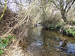
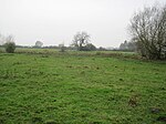
Ratcliffe-on-Soar is a village and civil parish in Nottinghamshire on the River Soar. It is part of the Rushcliffe district, and is the site of Ratcliffe-on-Soar Power Station. Nearby places are Kingston on Soar, Kegworth and Trentlock. With a population of around 100, measured at 141 in the 2011 Census, the parish is too small to have a parish council and so has a parish meeting. Although the village does not contain any shops, it has a church and a marina which is often affected by severe flooding as it built on designated floodplain, just before the Soar joins the River Trent at Trentlock.
Excerpt from the Wikipedia article Ratcliffe-on-Soar (License: CC BY-SA 3.0, Authors, Images).Ratcliffe-on-Soar
Kegworth Road, Rushcliffe
Geographical coordinates (GPS) Address Nearby Places Show on map
Geographical coordinates (GPS)
| Latitude | Longitude |
|---|---|
| N 52.854 ° | E -1.264 ° |
Address
Kegworth Road
NG11 0EA Rushcliffe
England, United Kingdom
Open on Google Maps


