Fulbourn Fen

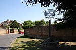
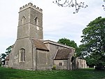
Fulbourn Fen is a 27.3-hectare (67-acre) biological Site of Special Scientific Interest east of Fulbourn, Cambridgeshire. It is privately owned and managed by the Wildlife Trust for Bedfordshire, Cambridgeshire and Northamptonshire.There are ancient meadows on calcareous loam and peat which have never been intensively farmed, so they have a rich diversity of flora and fauna. Herbs in drier areas include cowslip and salad burnet, while wetter areas have tall fen vegetation.There is access by a track from Stonebridge Lane.There are eight separately named woods in Fulbourn Fen: The Cringles - north & north-east Moat Wood - north-west Thackets Wood - west Ansett's Wood - south-west Old Orchard - south Hancock's Wood - central Widow's Wood - south-east Old Orchard - southand five separate meadows: Ox Meadow - west Moat Meadow - north-west - the site of the remains of Zouches Manor Long Fen Pasture - central East Fen Pasture - east Four Acre - south-east
Excerpt from the Wikipedia article Fulbourn Fen (License: CC BY-SA 3.0, Authors, Images).Fulbourn Fen
Stonebridge Lane, Cambridgeshire
Geographical coordinates (GPS) Address External links Nearby Places Show on map
Geographical coordinates (GPS)
| Latitude | Longitude |
|---|---|
| N 52.181 ° | E 0.236 ° |
Address
Fulbourn Fen NR
Stonebridge Lane
CB21 5BW Cambridgeshire (South Cambridgeshire)
England, United Kingdom
Open on Google Maps


