place

Rice City Historic District

Coventry, Rhode IslandHistoric districts in Kent County, Rhode IslandHistoric districts on the National Register of Historic Places in Rhode IslandKent County, Rhode Island Registered Historic Place stubsNRHP infobox with nocat
Use mdy dates from August 2023
CoventryRI RiceCityChurch

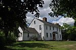
The Rice City Historic District is a historic district in Coventry, Rhode Island. It encompasses the 19th-century village of Rice City, extending along Plainfield Pike (Rhode Island Route 14) for several miles between Sisson Road and Gibson Hill Road in the northwestern part of Coventry. The main village center is at the junction of the Pike and Vaughn Hollow Road, and there is a former industrial and commercial center at Fairbank's Corner, the junction with Flat River Road (Rhode Island Route 117). The architecture of the district is predominantly rural and residential, with Greek Revival and Federal style housing predominating. Rice City village is dominated by Rice Tavern (built 1804), which used to serve travelers on their way to Connecticut, as well as the Rice City Church (1846), the Democrat Schoolhouse, and the Obadiah Potter House (1846), all a short way up Vaughn Hill Road. At the western edge of the district, the modern Pike alignment diverges from the historical one at Gibson Hill Road, where the foundational remnants of agricultural settlements may be found.The area was added to the National Register of Historic Places in 1980; an erroneously omitted property was formally added to the district in 2000.

Excerpt from the Wikipedia article Rice City Historic District (License: CC BY-SA 3.0, Authors, Images).

Rice City Historic District

Geographical coordinates (GPS) Address Nearby Places
placeShow on map

Wikipedia: Rice City Historic DistrictContinue reading on Wikipedia

Geographical coordinates (GPS)

Latitude Longitude
N 41.710277777778 ° E -71.764444444444 °
placeShow on map

Address


02827
Rhode Island, United States
mapOpen on Google Maps

CoventryRI RiceCityChurch
Share experience

Nearby Places

Anthony, Rhode Island

Anthony (previously known as Greenville and The Quaker Village) is a village along Route 117 within the town of Coventry, Rhode Island near the villages of Washington and Quidnick on the southwestern banks of the Pawtuxet River (Flat River). The village comprises "Anthony, Arnold, Boston, Mapledale, Meeting, Taft, Washington and Laurel Avenue."Previously, Anthony was known as "Greenville" and "The Quaker Village." In the eighteenth century, the Greene Family were early owners of the land and gave their name to the village where they operated a gristmill, forge, and sawmill. Many of the village residents, including the Greene family, were Quakers, members of the Society of Friends and part of the Greenwich Monthly Meeting, attending meetings at the Quaker Meeting House on Meeting Street, which was used for services from 1825 to 1915. The building is now a club house. Anthony was established and renamed in 1805 by William and Richard Anthony who built a textile mill in the village as part of the Coventry Manufacturing Company. By 1811 another cotton mill was built and later the Coventry Manufacturing Company operated in the area as well. The General Nathanael Greene Homestead is located near the village. The historic heart of the village, a 250-acre (100 ha) centered on Washington Street roughly between Sandy Bottom Road and Fairview Avenue and extending as far south as the Nathanael Greene Homestead, was named to the National Register of Historic Places in 2010 as the Anthony Village Historic District.