place

West Greenwich Baptist Church and Cemetery

1822 establishments in Rhode IslandBaptist cemeteries in the United StatesBaptist churches in Rhode IslandCemeteries in Rhode IslandCemeteries on the National Register of Historic Places in Rhode Island
Churches completed in 1822Churches in Kent County, Rhode IslandChurches on the National Register of Historic Places in Rhode IslandFederal architecture in Rhode IslandKent County, Rhode Island Registered Historic Place stubsNational Register of Historic Places in Kent County, Rhode IslandNortheastern United States church stubsRhode Island religious building and structure stubsWest Greenwich, Rhode Island
West Greenwich Baptist Church in West Greenwich RI Rhode Island USA

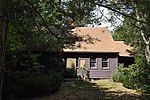
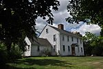
West Greenwich Baptist Church and Cemetery (also known as the Plain Meeting House) is a historic church meeting house and cemetery at Plain Meeting House and Liberty Hill Roads in West Greenwich Center, Rhode Island. It is the oldest building of this type in the western edge of Rhode Island. The Federal era "Plain Meeting" House was built around 1822 by the Independent and Union Society as a meeting house for the use of all local Christian congregations. The meeting house was named "Plain" after its location on the "plain" of West Greenwich Center. The building was used primarily by two Baptist congregations, the West Greenwich Baptist Church (founded in 1750) which believed in a Calvinist theology, and a branch of the Six Principle Baptist Church, which espoused an Arminian theology. The Six Principle branch had been planted by the Maple Root Six Principle Baptist Church located a few miles to the north. The two congregations merged in 1868 and continued to be known as the West Greenwich Baptist Church, maintaining sole custody of the building. Regular Sunday services were held well into the twentieth century and a Sunday School to study the Bible was held in the building as well. The building was added to the National Register of Historic Places in 1978.

Excerpt from the Wikipedia article West Greenwich Baptist Church and Cemetery (License: CC BY-SA 3.0, Authors, Images).

West Greenwich Baptist Church and Cemetery
Plain Road,

Geographical coordinates (GPS) Address External links Nearby Places
placeShow on map

Wikipedia: West Greenwich Baptist Church and CemeteryContinue reading on Wikipedia

Geographical coordinates (GPS)

Latitude Longitude
N 41.638055555556 ° E -71.752777777778 °
placeShow on map

Address

West Greenwich Baptist Church

Plain Road

Rhode Island, United States
mapOpen on Google Maps

linkWikiData (Q7985259)
linkOpenStreetMap (357263546)

West Greenwich Baptist Church in West Greenwich RI Rhode Island USA
Share experience

Nearby Places

Anthony, Rhode Island

Anthony (previously known as Greenville and The Quaker Village) is a village along Route 117 within the town of Coventry, Rhode Island near the villages of Washington and Quidnick on the southwestern banks of the Pawtuxet River (Flat River). The village comprises "Anthony, Arnold, Boston, Mapledale, Meeting, Taft, Washington and Laurel Avenue."Previously, Anthony was known as "Greenville" and "The Quaker Village." In the eighteenth century, the Greene Family were early owners of the land and gave their name to the village where they operated a gristmill, forge, and sawmill. Many of the village residents, including the Greene family, were Quakers, members of the Society of Friends and part of the Greenwich Monthly Meeting, attending meetings at the Quaker Meeting House on Meeting Street, which was used for services from 1825 to 1915. The building is now a club house. Anthony was established and renamed in 1805 by William and Richard Anthony who built a textile mill in the village as part of the Coventry Manufacturing Company. By 1811 another cotton mill was built and later the Coventry Manufacturing Company operated in the area as well. The General Nathanael Greene Homestead is located near the village. The historic heart of the village, a 250-acre (100 ha) centered on Washington Street roughly between Sandy Bottom Road and Fairview Avenue and extending as far south as the Nathanael Greene Homestead, was named to the National Register of Historic Places in 2010 as the Anthony Village Historic District.