place

Grafton and Burbage railway station

Disused railway stations in WiltshireFormer Midland and South Western Junction Railway stationsPages with no open date in Infobox stationRailway stations in Great Britain closed in 1961Railway stations in Great Britain opened in 1882
Use British English from April 2017
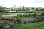
Grafton & Burbage former station geograph 3568213 by Ben Brooksbank

Grafton and Burbage railway station served the villages of Burbage and East and West Grafton in Wiltshire, England. The station was on the Midland and South Western Junction Railway. It opened in May 1882 as the northern terminus of the southern section of the Swindon, Marlborough and Andover Railway and became a through station when the line from Swindon was completed through a new Marlborough station and the Great Western Railway's Savernake station in February 1883. In 1883, a northwards extension, the Swindon and Cheltenham Extension Railway, opened from Swindon Town to Cirencester, with further northward extension to a junction with the Great Western Railway's Cheltenham to Banbury at Andoversford opening in 1891, enabling through trains from the Midlands to the south. The SM&AR and the S&CER amalgamated in 1884 to form the M&SWJR. In 1898, a new section of line, called the Marlborough and Grafton Railway, was opened between the M&SWJR station in Marlborough and Grafton & Burbage station, with an intervening stop at a high level station at Savernake. This removed the need for M&SWJR trains to run on the GWR lines, though junctions to the GWR line heading both east and west were retained north of Grafton station. Grafton and Burbage station was sited at West Grafton on a double-track section of the line. It had a small main building on the down platform (towards Andover), with a large signalbox that controlled what had become a complex junction. The up platform had a wooden shelter. There was a small goods yard to the north of the station. Station signs on the platforms referred to it as "Grafton" station; in timetables and on other printed material, however, it always appeared as "Grafton and Burbage". As a whole, traffic on the M&SWJR fell steeply after the Second World War and the line closed to passengers in 1961, with goods facilities withdrawn from this section of the line at the same time. The station building has now been incorporated into a larger residential house, with the space between the platforms where the track ran forming part of the garden.

Excerpt from the Wikipedia article Grafton and Burbage railway station (License: CC BY-SA 3.0, Authors, Images).

Grafton and Burbage railway station
A338,

Geographical coordinates (GPS) Address Nearby Places
placeShow on map

Wikipedia: Grafton and Burbage railway stationContinue reading on Wikipedia

Geographical coordinates (GPS)

Latitude Longitude
N 51.3433 ° E -1.6453 °
placeShow on map

Address

A338
SN8 3DD , Grafton
England, United Kingdom
mapOpen on Google Maps

Grafton & Burbage former station geograph 3568213 by Ben Brooksbank
Share experience

Nearby Places

Bruce Tunnel
Bruce Tunnel

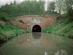
The Bruce Tunnel is on the summit pound of the Kennet and Avon Canal between Wootton Top Lock and Crofton Locks in Wiltshire, England. The tunnel is 502 yards (459 m) long. It is named after Thomas Brudenell-Bruce, 1st Earl of Ailesbury (1729–1814), the local landowner, who, when the canal was being built, would not allow a deep cutting through his land, and insisted on a tunnel instead. At the eastern end of the tunnel is a plaque commemorating its construction: The tunnel has red brick portals, capped with Bath stone, each with a decorative plaque of Pennant stone. Construction was begun in 1806 and finished in 1809. It is lined with English bond brickwork and has a wide bore to cope with the 'Newbury Barges' used on this canal. There is no towpath through the tunnel, so walkers and cyclists must walk across the top of the hill. When canal boats were still pulled by horses, the boatmen had to haul boats through the tunnel by hand, pulling on chains that ran along the inside walls. The tunnel is about 1.3 miles (2 km) north of Burbage village. To the north lies the Savernake Forest which is open to the public with footpaths, drives and picnic sites, hence the tunnel is also sometimes known as the Savernake Tunnel. The main Paddington to Penzance 'Berks and Hants' railway line crosses the tunnel diagonally; both portals can be seen (from different points along the railway) from the windows of passing trains with the canal running close to the railway at each end.

Tottenham House
Tottenham House

Tottenham House is a large Grade I listed English country house in the parish of Great Bedwyn, Wiltshire, about five miles southeast of the town of Marlborough. It is separated from the town by Savernake Forest, which is part of the Tottenham Park estate. The site of the house was part of the much larger Savernake Forest, and in the Middle Ages was controlled by heads of the Esturmy family. In the 15th century, the land passed by marriage to the House of Seymour of nearby Wulfhall, about one mile to the south. The original house was probably built in about 1575 by Edward Seymour, 1st Earl of Hertford, a nephew of Queen Jane Seymour, when it was known as Totnam Lodge. The present house incorporates parts of the earlier houses on the site built by the Seymours. In 1675, the estate passed to Lady Elizabeth Seymour, who married Thomas Bruce, 2nd Earl of Ailesbury, thus bringing the house into the Bruce family. In 1721, Elizabeth Seymour's son and heir, Charles Bruce, 3rd Earl of Ailesbury, rebuilt Totnam Lodge to the design of his brother-in-law the pioneering Palladian architect Lord Burlington, and parts of the grounds, including the kitchen garden, were laid out by Capability Brown between 1764 and about 1770. The house underwent a number of further rebuilds, and the current house, containing more than one hundred rooms, mostly dates from the 1820s, having then been remodelled by Charles Brudenell-Bruce, 1st Marquess of Ailesbury, who in 1818 (while still Earl of Aylesbury) had added a new range of stables designed by Thomas Cundy. The Bruce family lived in the house until 1946. Thereafter it was used as a preparatory school until 1994, and then leased to a charity until 2005, after which it was unoccupied for some ten years, apart from a period in 2006, when the band Radiohead recorded part of their album In Rainbows at the house. It was then leased for 150 years to a US-based consortium with the intention of creating a luxury hotel and golfing centre, but the consortium went bankrupt in 2008. In 2014, the house was sold for £11.25m to an undisclosed buyer who had plans to turn it back into a private home.