Hatherop
Cotswold DistrictUse British English from March 2015Villages in Gloucestershire

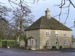
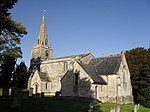
Hatherop is a village and civil parish in the Cotswolds Area of Outstanding Natural Beauty, about 2.5 miles (4.0 km) north of Fairford in Gloucestershire, England. The River Coln forms part of the western boundary of the parish.
Excerpt from the Wikipedia article Hatherop (License: CC BY-SA 3.0, Authors, Images).Hatherop
Cotswold District Hatherop
Geographical coordinates (GPS) Address Nearby Places Show on map
Geographical coordinates (GPS)
| Latitude | Longitude |
|---|---|
| N 51.745 ° | E -1.776 ° |
Address
GL7 5AB Cotswold District, Hatherop
England, United Kingdom
Open on Google Maps


